 TM
TM(Advertisement)
Tube City Community Media Inc. is seeking freelance writers to help cover city council, news and feature stories in McKeesport, Duquesne, White Oak and the neighboring communities. High school and college students seeking work experience are encouraged to apply; we are willing to work with students who need credit toward class assignments. Please send cover letter, resume, two writing samples and the name of a reference (an employer, supervisor, teacher, etc. -- not a relative) to tubecitytiger@gmail.com.
Ads start at $1 per day, minimum seven days.
Flooding Hits Area After Record Rainfalls
Area roads closed; weather observers report 3 inches of rain from Tuesday’s storms
By Staff Reports
The Tube City Almanac
April 03, 2024
Posted in: State & Region
This is a developing story and will be updated as necessary.
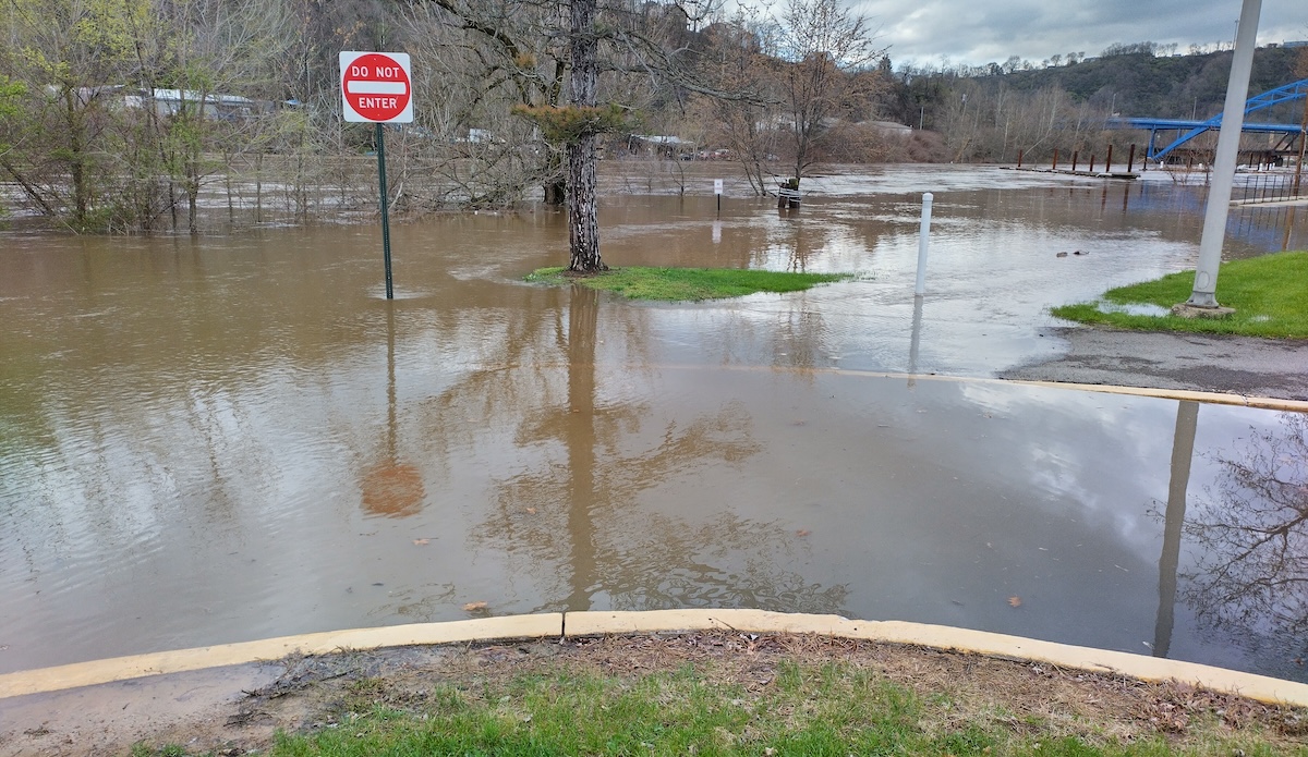
Water topped the end of Ninth Avenue near Kane Regional Center on Wednesday afternoon. (Tube City Almanac photo)
Roads remain closed throughout the Mon-Yough area after record rainfalls dropped up to 4 inches of rain on parts of Western Pennsylvania.
The Youghiogheny River is overflowing its banks in Elizabeth Twp. and water was lapping at the edge of the parking lot at McKees Point Marina.
City officials reported that the West Fifth Avenue end of the Mansfield Bridge was closed Wednesday morning due to flooding, while in White Oak, Route 48 was closed between Cool Springs Road and Lincoln Way; and Lincoln Way was closed between Route 48 and Coulterville Road.
White Oak police reported that Lincoln Way had reopened at noon Wednesday, but that part of Route 48 remained closed while crews removed debris from the road.
The stretch of River Road between lower 10th Ward and Port Vue was closed Wednesday afternoon due to flooding and a landslide, the McKeesport Fire Department reported.
The state Department of Transportation reported that Route 837 was closed between the McKeesport-Duquesne Bridge and Dravosburg due to flooding. A section of Route 837 in West Mifflin also was closed, borough police said.
A strong storm system that arrived in California last weekend — causing parts of that state’s fabled Highway 1 to fall down a cliff into the Pacific Ocean — made its way across the United States on Tuesday, triggering blizzards and floods in the western part of the country, tornadoes in Indiana, and heavy thunderstorms in Ohio and West Virginia.
Between 4 and 5 inches of rain has already fallen on the Mon-Yough area over the past four days, according to the National Weather Service in Moon Twp., with areas west and north of Pittsburgh reporting even heavier rainfall. During Tuesday alone, 3.5 inches of rain were reported by NWS observers in northern Allegheny County.
The official total for Tuesday — 2.68 inches as measured near Pittsburgh International Airport — set a daily record for April 2. The all-time one-day rainfall record for Pittsburgh was 5.95 inches, set in 2004 during Hurricane Ivan, though other record-setting storms have dropped 3 inches of rain in a single day.
At 6 a.m. Wednesday, weather observers at Braddock Lock & Dam said that more than 3 inches of rain had been measured there over the previous four days.
The National Weather Service issued flash-flood warnings throughout the region on Tuesday and a flood warning remained in effect on Wednesday until 3:45 p.m. Unlike a watch, which means that a hazardous condition is possible, a warning means that flooding is already occurring.
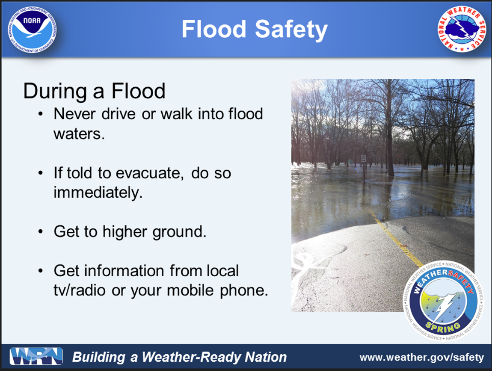
The weather service and emergency management officials were urging motorists not to drive through flooded areas, or streets where water was “ponding.”
“While the worst of the storms are past, flooding locally from streams, creeks and backed up storm drainage will continue to increase road closures and potential flooding damages,” county spokeswoman Kasey Reigner said in a prepared statement. “Area rivers continue to rise and are not expected to crest until mid-morning Thursday.”
“As the rivers continue to rise, the streams and creeks leading to the rivers will begin to back up and add more area flooding to low lying areas countywide,” she said. “Additional road closures, flooding and landslides are expected into, at least, Friday morning.”
Swiftwater and flood response teams were continuing to monitor and respond to emergencies, Reigner said.
(Source: National Weather Service)
Observers from the U.S. Geological Survey reported early Wednesday that since the beginning of the week, the Youghiogheny River at Sutersville had risen from 3 feet to 21 feet and was expected to continue rising for several hours. Flood stage is 20 feet.
The Monongahela River at Elizabeth was continuing to rise on Wednesday morning and forecasters said Wednesday afternoon the river is now expected to peak at 21 feet, 1 foot over flood stage. Normal levels are 9 to 11 feet.
At Braddock, water levels began sharply rising on Tuesday. The river is expected to crest at 22 feet, near flood stage. Normal pool levels are approximately 12 feet, USGS said.
When the river reaches 22 to 23 feet at Braddock, according to USGS, backwater flooding in Downtown McKeesport — including at McKees Point Marina — begins.
Barge navigation through the locks at Braddock and Elizabeth is currently suspended due to high water levels.
Water levels in Turtle Creek crested early Wednesday morning and had begun falling, according to USGS.
According to Allegheny County emergency management officials, volunteer firefighters were responding to numerous localized flooding calls, including streets and basements, in Coulter (South Versailles Twp.), Dravosburg, Glassport, Elizabeth Twp., Forward Twp. and other communities.
Part of the Buena Vista parklet and boat launch in Elizabeth Twp., near the Great Allegheny Passage bike trail, was flooded on Wednesday, and KDKA-TV showed video of a discarded television set floating down Fifth Avenue in McKeesport’s East End.
In downtown Pittsburgh, the so-called “bathtub” section of Interstate 376 along Fort Pitt Boulevard was living up to its name, and also was closed. North Huntingdon Twp. police reported that Park Hill Road, Leger Road, Mahaffey Hill Road and Route 993 all were closed.
The NWS said that streams and rivers will continue to rise through the day and remain swollen into the weekend, with the Ohio River expected to begin going back down on Saturday.
Heavier precipitation will be replaced with lighter, occasional showers, the weather service said, and cooler temperatures will persist, with some snow showers expected later in the week. Forecasters said that dry weather is expected to return this weekend.

(Source: National Weather Service)
Originally published April 03, 2024.
In other news:
"New Police Initiative…" || "Landslide Closes Stre…"